REVIEW · SA PA
Sa Pa: The Roof of Indochina – Fansipan Hiking Full-Day Trip
Book on GetYourGuide →Operated by Sapa Trekking Hiking Tours · Bookable on GetYourGuide
Fansipan isn’t a stroll. It’s a full-day climb to the Roof of Indochina, with jungle walking, big mountain views, and the kind of summit payoff that sticks with you. I especially loved the practical small-group setup (up to 15 people) and the way the local guide keeps the route understandable when the trail gets steep and rocky. One possible drawback: it’s not beginner-friendly, and you should expect a hard, uphill day.
In This Review
- One thing to weigh before you commit
- Key points to know before you lace up
- Fansipan by foot: what this full-day trip really feels like
- Route and timing: Tram Ton Pass to the summit in one push
- Stops that matter: Muong Hoa Valley views and the 2,800 m lunch break
- Guides and small-group pacing: why this tour feels safer
- Price and value: what $72 covers (and what costs extra)
- What to bring and how to not hate the last hour
- Who this Fansipan hike suits best (and who should skip it)
- Should you book this Fansipan hiking trip from Sa Pa?
- FAQ
- How long is the Fansipan hike day from Sa Pa?
- What distance do I hike each way?
- Do I need cable car tickets to complete the trip?
- What time does the tour start?
- Is the guide available in English?
- Is lunch included, and where do we eat?
- What’s included for pickup and drop-off?
- What should I bring for the hike?
One thing to weigh before you commit
The hike is long (12 km each way), and the altitudes stack up quickly—lunch happens at about 2,800 m, then you still go higher to reach the summit. If you have back issues, you’re pregnant, or you’re not comfortable with sustained climbing, this one can feel like too much.
Key points to know before you lace up
- Tram Ton Pass start + summit end: you drive up first, then hike the whole way to the top of Fansipan.
- 12 km one-way is the real number: plan around a long uphill effort (about 6 hours to reach the top).
- Lunch at altitude: you recharge around a hut at roughly 2,800 m for about 30 minutes.
- Hoang Lien National Park access: park tickets and permits are included.
- English guide plus small-group pace: an English live guide helps you move safely on a tricky trail.
- Gear is mostly handled: raincoat, gloves, and a walking stick are included for the hike.
Fansipan by foot: what this full-day trip really feels like
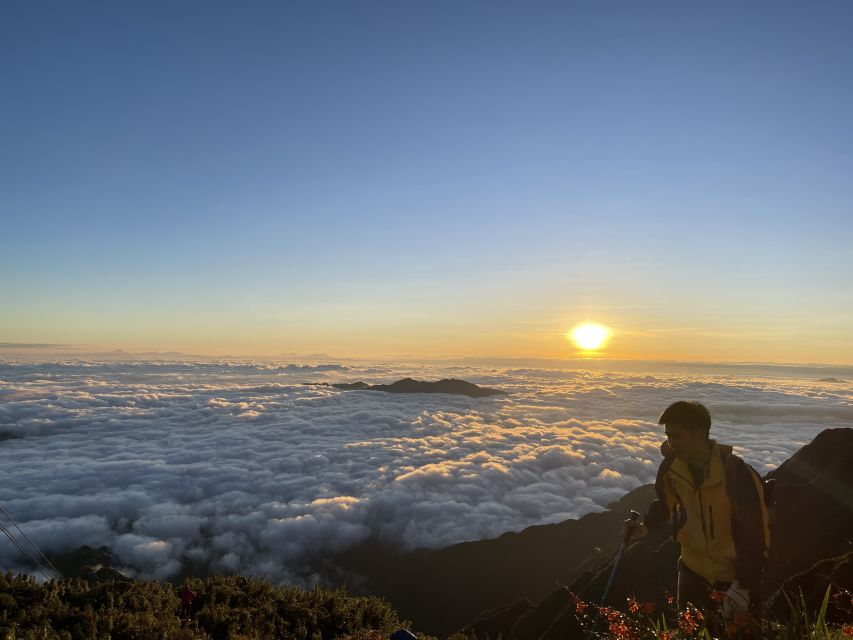
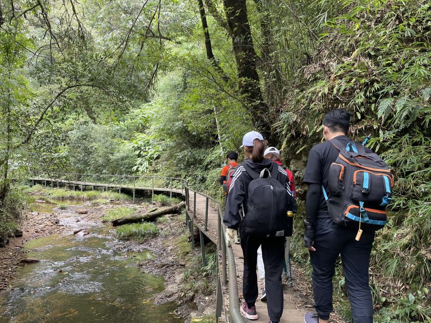
This is a hike day designed for people who want effort, not just photos. You’ll start near Tram Ton Pass and work your way up through dense forest, with repeated uphill sections that never really let the legs rest. The reward is the sense that you’re actually earning those sweeping views down toward the Muong Hoa Valley and beyond.
I like that the trip is built around clear stages: drive up, hike up through the jungle, pause for lunch at altitude, then finish at the summit for photos. That structure makes it easier to pace yourself than a vague walking tour. Plus, because the group size is capped at 15, you usually don’t feel lost in a crowd of strangers.
The “Roof of Indochina” nickname is earned here. Even if the air gets misty (it can happen), the route itself is still the point: the trail texture, the change in vegetation as you gain altitude, and the mental checklist of reaching each milestone.
Route and timing: Tram Ton Pass to the summit in one push
After pickup in Sa Pa (within 1 km of the church), you’ll travel to Tram Ton Pass in about 30 minutes. Then the hike begins with a 12 km route that takes roughly 6 hours to reach the top. If you’re the type who likes to know what your day looks like, this is refreshingly concrete.
The walking is described as a 12 km each-way track (so about 24 km total if you go up and back on foot). One of the more helpful ways to frame it is to think in elevation and stamina, not distance alone. Reviews also mention steep, rocky sections and a lot of climbing. In practical terms: you’ll likely feel it in your calves and quads before you ever “feel” the summit.
A typical flow looks like this:
- You hike from about the pass level through jungle sections as you gain altitude.
- You reach an area around 2,200 m, then follow a trail along the mountainside.
- Around 2,800 m, you stop at a shack for lunch (about 30 minutes).
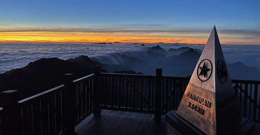
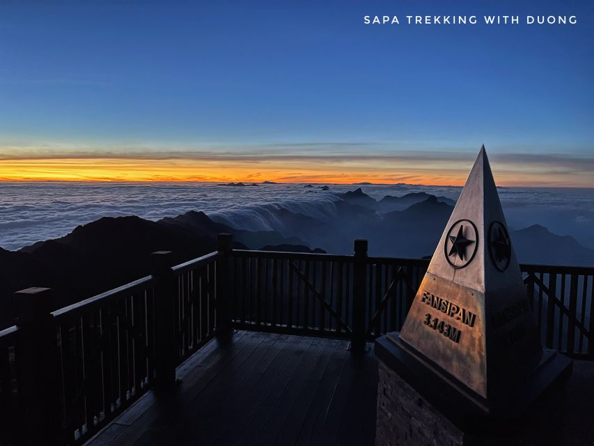
- Then you continue to the summit area for photos and time to take in the views before heading back down.
One caution: if the weather is humid or rainy, the trail can get slippery. The path can be uneven, so trekking poles and good footing matter more than speed.
Stops that matter: Muong Hoa Valley views and the 2,800 m lunch break
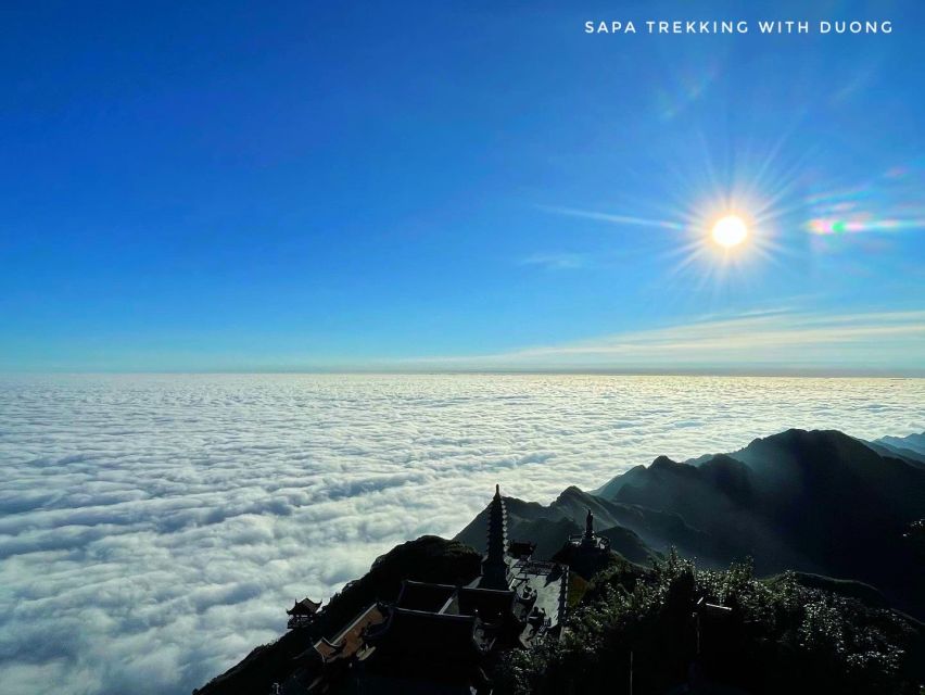
This itinerary is worth doing because it gives you view stops that break up the grind. You don’t just slog upward and hope something pretty appears at the end.
At the mountainside section, you’re aiming for big sightlines over the Muong Hoa Valley and toward Lai Chau Province. This is the point where the hike stops being only physical. The higher you go, the more you notice how far the valley stretches and how the mountain ridges layer into the distance.
Then you get lunch at around 2,800 m. That matters more than you might think. By the time you’re at that height, your body wants fuel, and your brain wants a pause that isn’t just breath-catching. The lunch stop is also where you’ll likely feel the temperature shift. A few reviews note warm noodles and solid meals served during the hike, sometimes in a hut at that altitude.
Dietary notes: one review mentions a vegetarian option, and another mentions gluten-free accommodation on short notice. The tour data doesn’t promise dietary flexibility, but the fact that guides have handled special requests is encouraging. If you need something specific, bring it up when you book.
Guides and small-group pacing: why this tour feels safer
This trip runs with a live English tour guide and an English audio guide. In the field, that usually means two things: explanations are clear, and route decisions don’t feel like you’re guessing.
The guides also seem to be the reason this tour earns strong scores. Names that show up in experiences include Mr Chu, Chau, Thong, Tung, Pao, and Gio. Across those accounts, the common theme is supportive guidance on steep parts and helpful organization once you’re already sweaty and tired. People mention guides providing equipment, cooking meals during the hike, and staying patient when the pace slows.
The small group limit (up to 15) helps here. On a trail like this—steep and rocky—being able to move as a group without constant re-grouping is a real quality-of-day factor. You get better pacing, and it’s easier to ask questions about footing or weather.
One more detail: at the summit, some groups report receiving a medal and certificate of completion. That’s not listed in the tour basics, but it’s a nice morale boost if your operator includes it on your day.
Price and value: what $72 covers (and what costs extra)
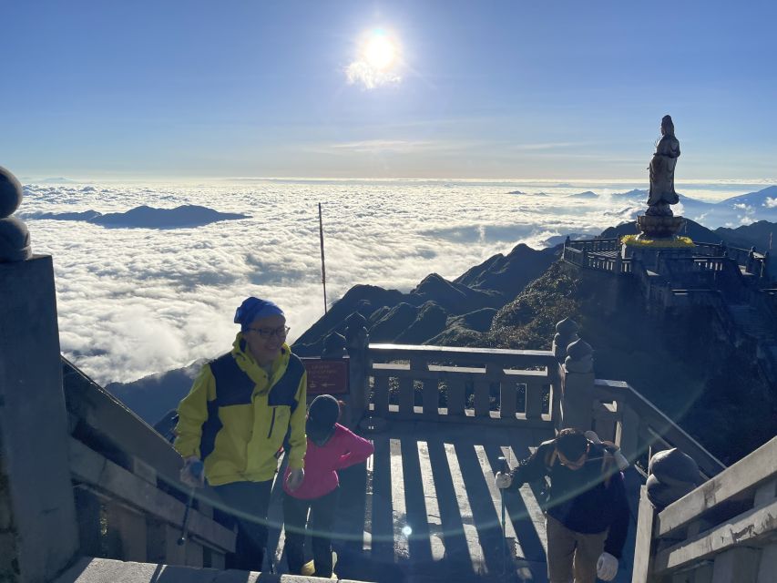
At $72 per person for about 10 hours, this is a pretty direct deal for a high-altitude day. You’re not paying only for the hike. You’re paying for the whole package that makes the climb feasible as a visitor.
Here’s what’s included:
- Roundtrip transportation from Sa Pa
- Hotel pickup and drop-off within 1 km of the church
- Local guide (English)
- Hoang Lien National Park entry tickets and permit
- Lunch (served around the 2,800 m area)
- Water (1.5 liters per person)
- Hike support gear: raincoat, gloves, and a walking stick
What’s not included:
- Cable car tickets (listed at 850,000 VND)
That cable car add-on matters because it changes how you manage risk and energy. If weather turns or your legs are cooked, some people switch to cable car for the way down. One review even notes choosing cable car down due to rain, while another group returned on foot when cable car access wasn’t working. The key point for you: plan your energy as if you’ll hike both ways, then treat cable car as a safety valve, not the main plan.
From a value standpoint, the “included park permits + guide + lunch + gear + water” combo is what makes this cost make sense. If you tried to piece that together yourself, it’s the guide/permits part that usually gets expensive and annoying.
What to bring and how to not hate the last hour
This hike gives you raincoat, gloves, and a walking stick, which is great. Still, you control the rest.
Bring:
- Passport or ID card
- Hiking shoes (seriously; slick rocks + wrong footwear is a bad day)
- Sunscreen
- Comfortable clothes
- Sports shoes if you prefer them, but keep traction in mind
- Cash
How to pace yourself:
- Expect the trail to be steep and rocky. Even if your fitness is decent, plan for slow going.
- Start “conservatively.” The hardest part is often not the steepest moment—it’s the second hour when your body realizes it’s not a short climb.
- If you’re afraid of heights, focus on your steps and your own breathing rhythm. One review specifically mentions not being afraid of heights as important.
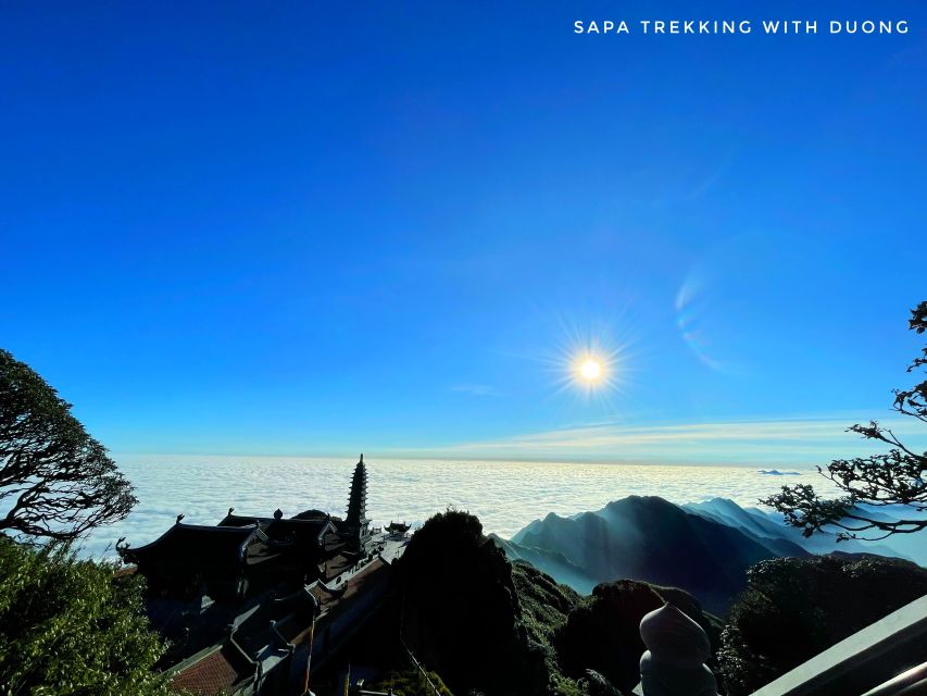
Also, pack for changing conditions. Higher elevation can feel colder and windier. If you get a misty summit day, you might not get the views you were hoping for, but you’ll still get the satisfaction of reaching the top and seeing what you can.
Who this Fansipan hike suits best (and who should skip it)
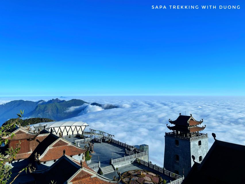
This is best for you if:
- You want a single-day summit challenge rather than a slow trek tour
- You’re comfortable with long walking (24 km total if doing both ways)
- You like routes with a real guide and a clear “climb stages” plan
- You want included lunch and gear so you can focus on walking
It’s a poor fit if:
- You’re pregnant
- You have back problems
- You want something gentle or stroller-friendly
- You’re under 18 years old (the tour notes children under 18 are not suitable)
There’s also a “comfort” filter. Even fit walkers can find parts tough if the weather is humid or if you dislike rocky footing. If you know steep hiking is stressful for you, consider whether you can use the cable car option (which isn’t included, but is available) as a backup.
Should you book this Fansipan hiking trip from Sa Pa?
If you’re chasing a serious day outside and you’re ready for steep uphill work, I think this is a strong booking choice. The value is in the bundle: transport + guide + park permits + lunch + water + hike gear for one fixed price. And the small group limit helps keep the experience organized when the trail gets difficult.
I would not book if you’re looking for an easy nature walk or if your body can’t handle long climbing. This isn’t designed to be gentle, and the trail conditions can demand more from you than you expect.
My simple decision rule: if you can comfortably walk uphill for hours at a time and you’re happy to take it slow, you’ll likely feel proud when you reach the summit area—even if the weather steals some visibility.
FAQ
How long is the Fansipan hike day from Sa Pa?
The full trip is listed as about 10 hours. The hike to the top takes about 6 hours.
What distance do I hike each way?
You hike about 12 km each way, for roughly 24 km total if you do both directions on foot.
Do I need cable car tickets to complete the trip?
Cable car tickets are not included. You can choose to hike down or use the cable car if you have tickets.
What time does the tour start?
The duration is 10 hours, and starting times depend on availability.
Is the guide available in English?
Yes. The live tour guide is listed as English, and an English audio guide is included.
Is lunch included, and where do we eat?
Lunch is included, served around the 2,800 m area, with about 30 minutes set aside for the meal.
What’s included for pickup and drop-off?
Pickup and drop-off are included within 1 km of the church in Sa Pa, plus roundtrip transportation.
What should I bring for the hike?
Bring your passport or ID, hiking shoes, sunscreen, comfortable clothing, and cash.